
WINGXPAND Works Where You Do.
TM
Public Safety
Protect and secure, from the city to the disaster zone. Anywhere at anytime, always ready to expand safety.
-
Immediately map and observe widespread areas for rapid situational awareness.
Establish immediate secure communications and internet network.
Replace or supplement costly helicopters.
-
Monitor large crowds or public events to ensure safety and prevent potential threats.
Locate lost or missing persons in vast areas or challenging terrains.
Capture comprehensive scene imagery and details for crime scene analysis.
Track suspects evading police allowing for safer apprehension
-
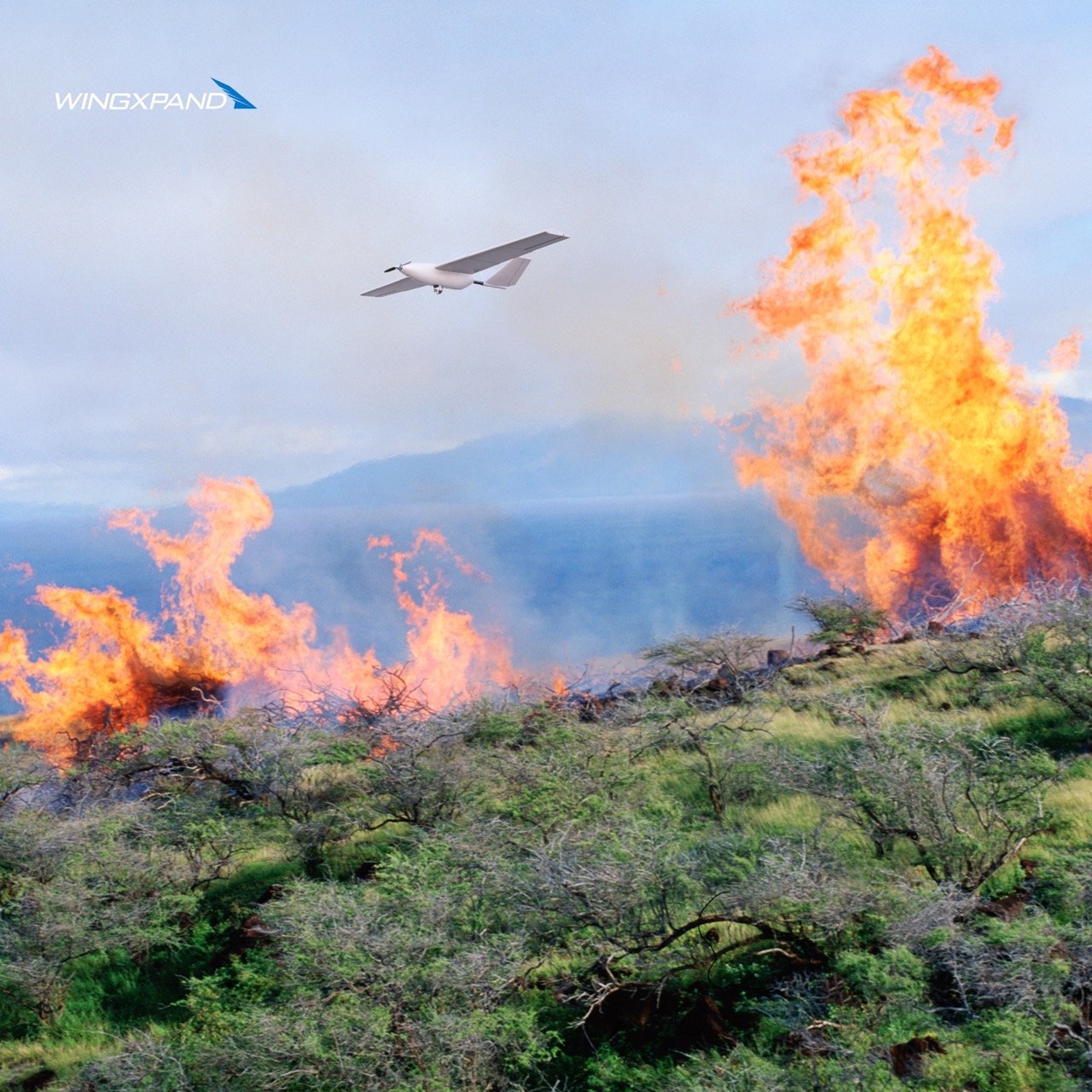
Rapidly launch where it’s needed most. Save lives impacted by wildfires, hurricanes, tornados, typhoons, tsunamia, earthquakes, landslides, flooding, avalanchea, mudslides, and hazardous chemical spills.
Lead search, recovery, and evacuation efforts. Assess utility, infrastructure, and property damage.
Defense
Protect and defend, from the city to the battlefield. Truly rucksack portable.
-
Military grade Group 1 unmanned aerial vehicle (UAV) that fits in a rucksack, maximizing capability in the smallest logistics footprint.
Modular open systems architecture capable of carrying mesh radios for secure, assured communications, specialty payloads (EO/IR, SIGINT, lidar), and edge AI enabled cooperative multi-aircraft operations to improve velocity of targeting.
Don’t compromise capability for size.
-
Gather intel on positions and movements.
Create an ad-hoc communications network without additional infrastructure.
Identify and track potential threats to keep teams and civilians safe.
Deliver supplies, equipment, and medical aid to remote or dangerous locations.
Locate and identify explosives and landmines from a safe distance.
-
Real-time data for decision making in rapidly changing environments
Quickly cover large expanses of open water to locate distressed vessels, downed aircraft, or individuals overboard.
Monitor oceanic and atmospheric conditions, aiding in navigation and operational planning during diverse weather situations.

Survey & Inspection
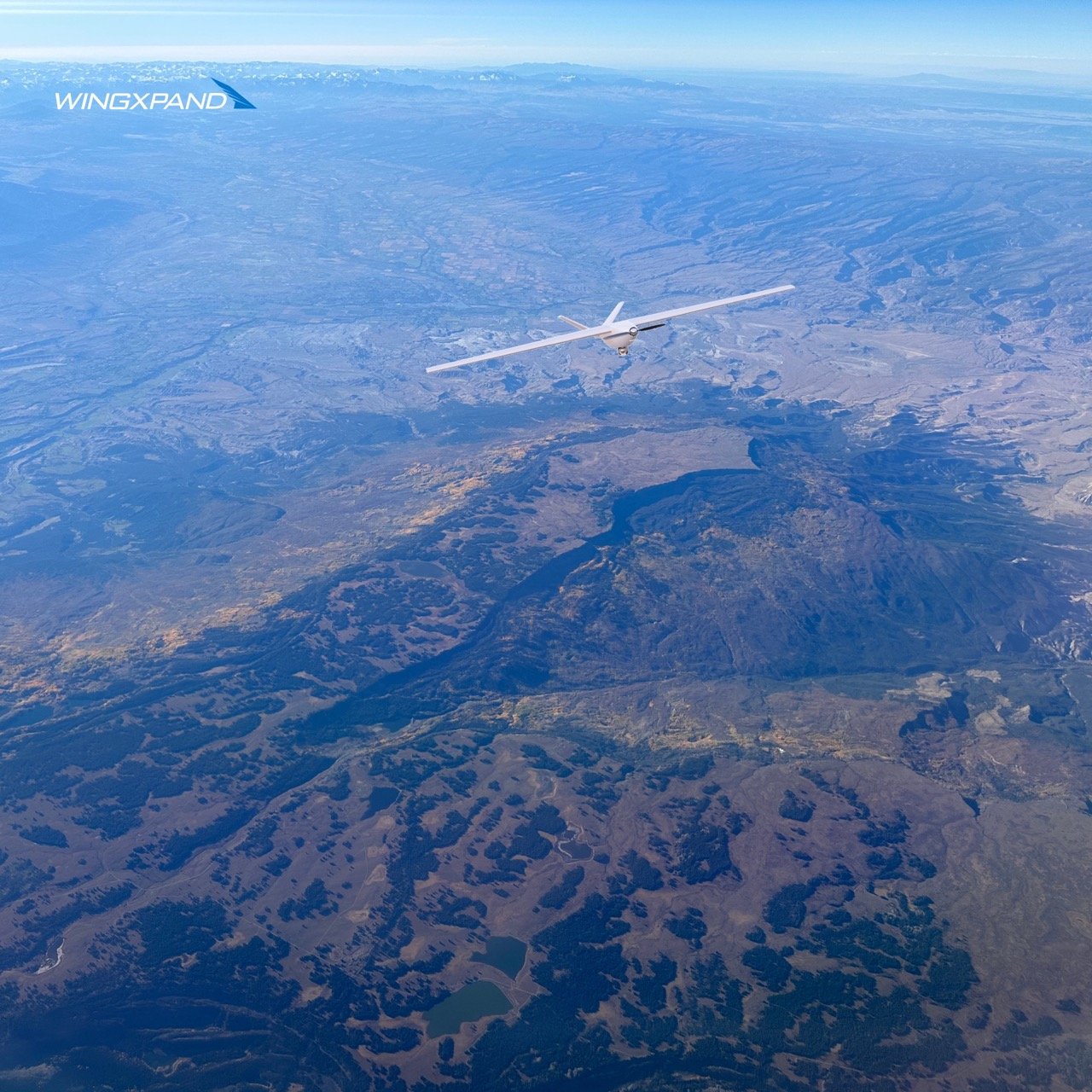
Fly long to create GPS referenced maps to replace time-consuming, manual, groundwork.
-
Map, survey and inspect. Aerial data and visual verification prevents problems. Oversee materials, machinery, and people for safety and efficiency.
-
Manage stockpiles and tailing dams. Optimize drilling/blasting planning and hauling route.
Secure your site around the clock.
-
Reduces risk and costs of regular utility, pipeline, and other infrastructure inspections. Supports earlier detection of leaks and breakages through routine checks.
Defense

Insurance
Field deploy to accurately observe damage and disaster impacts faster than anything else possible.
-
Provides data for engineering risks and pricing.
Monitor natural disaster threats. -
Precise data and imagery improves claims adjudication and prevents fraud.
Deliever relief to those impacted, faster.

Agriculture
In an unpredictable world— get a clearer view of every corner of your land.
-
Identify disease, drought, and pests from anywhere on the farm, preventing problems before they start.
Measure nutrients and plan for drainage.
Water and fertilizer reports allow you to take action to increase yield.
-
Track animal growth, disease and prevent premature death.
Find stray animals and prevent theft.
Easily reach difficult to access areas.
Observe pasture health and fencing.
Expanding What’s Possible for Those That Keep Our World Running
TM
Wider Coverage + More Capability.
Walk into any situation ready to fly. 5x longer flights than quadcopters means a wider coverage area plus the pro tools you need to get the job done the first time.
Cost and Time Savings.
Get up in the air faster with the full spectrum of tools you need. Replace high-cost, limited aerial assets like helicopters, planes, and satellites.
Real-time Assessments with Smart Sensing Recognition.
Don’t miss a thing. Tap into the onboard hi-res camera and customizable sensors to review your data in the field. With WINGXPAND’s Edge AI payload you can pre-set what you want the drone to flag so it can take a closer look all on its own.
No Comms. No problem.
Establish secure, reliable communications and internet when you need it most. Stretch the network coverage area through a fleet of WINGXPAND™ drones.